
Walk a Butler County Street
A street-by-street search in Butler County works parcel by parcel. The Auditor's property system identifies the parcel tied to a number and street, while the GIS map adds boundaries and nearby road context. The Recorder then connects an owner or legal description to recorded instruments. Those sources establish a property trail, not a complete household list. Ohio's individual voter lookup is a limited confirmation tool, and a historic directory is tied to the edition date. Keep those limits in view before combining the results.
- Open the Butler County Auditor address search and enter the street number and street name. Review the results in address order, open the matching parcel, and record its PIN, owner label, situs, legal description, and transfer clues.
- Check the same location in the Butler County Auditor GIS Viewer. Its search accepts a PIN, owner, or address, and the parcel map helps distinguish a road label from a municipal or township boundary.
- Use the parcel owner, legal description, and transfer date in Recorder Cloud Search Advanced Search. Search the current owner as grantee, select a deed-related type, and compare the grantor, document reference, recorded date, and legal description.
- For a narrow registration check, use the official Ohio voter lookup with the required identity inputs. It is not a public tool for browsing every voter along a road, and protected records remain restricted.
- For a past household, inspect a reverse or street guide only when that volume has one. The MidPointe 1949 Middletown directory is documented with a householder and street guide; pair its entry with a close map, deed, or census record.
Write down the date for every result. A parcel may change hands, a road can be known by an older form in a directory, and a current map does not establish who occupied a house in an earlier year.
Butler County Address Fields
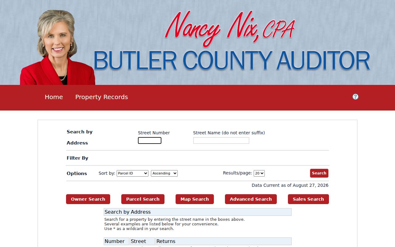
The Auditor is the strongest starting point for the modern street directory because it accepts a number and street name directly. It is also a property and tax system. The basic address screen does not offer ZIP or city controls, so a postal label alone will not find a Butler County parcel. Use the owner's name only after checking that the property result is the right one. The owner search takes a name in LASTNAME FIRSTNAME order and allows the asterisk as a wildcard, but that wildcard behavior is not documented as an address-search feature.
| Auditor field | Type | Required | Documented use |
|---|---|---|---|
| Owner | Text | No | Enter LASTNAME FIRSTNAME without commas, in full or part; * works as a wildcard. |
| Number | Text | No | Street-number component of the address search. |
| Street | Text | No | Street-name component of the address search. |
| Parcel Number | Text | No | All or part of a parcel number returns partial matches. |
| Advanced criteria | Builder | No | Includes sale, value, acreage, neighborhood, tax district, and building criteria. |
A result list can be sorted by parcel ID, owner, parcel address, roll, transfer or sale date, and price. It can show 10 to 50 results per page. That makes it practical to review a short street segment without claiming that the list names each current occupant.
The Auditor address-search screen shows the field layout used for a Butler County street directory search.
Use the returned parcel as the bridge to title, tax, and map records, rather than treating the first matching address as a household roster.
Map a Butler County Street
The Butler County GIS Viewer provides a visual check after an address search. Its one search box is labeled “Search by PIN, Owner, or Address,” allows partial matching, and is configured to return PIN, OWNER, and LOCATION with up to six suggestions or results. Click a parcel to compare the polygon with the property record. The viewer is useful where a street crosses a township, municipality, flood-hazard area, or different tax district.
Current parcels, roads, township and municipal boundaries, FEMA flood-hazard areas, and historic imagery from 2014, 2017, 2018, 2020, 2022, 2023, 2024, and 2026 are documented layers. The map also has point, box, polygon, and freehand selection tools. Its proximity buffer defaults to 100 feet and can use feet or meters with center points or polygons. Those controls help organize nearby parcels, but the parcel map is not proof of current household membership.
Note: The public parcel service limits a query to 2,000 features, so a focused road segment is more reliable than a broad countywide export.
Butler County Deed Trail
Cloud Search turns a parcel lead into a recorded-document trail. Start with the owner's acquisition as grantee and compare the deed's legal description before moving to the earlier grantor. Search that prior grantor as grantee to find an earlier acquisition. A legal description, such as lot, block, subdivision, condominium, township, or metes-and-bounds wording, is often the continuity bridge when a street address is absent or changed in an older instrument.
The Recorder says documents recorded from 1987 to the present are online. Cloud Search nevertheless shows an index timeline beginning January 1, 1800. These statements describe different things: historical index visibility is not a promise that every older image is online. Cloud Search can search index-only data or index and OCR full text. Its Advanced Search also supports party tokens, document type, book and page, document number, recorded dates, and legal-description groups. Begin with index-only when precise metadata is needed, then use OCR carefully because it can add noise.
For older Butler County instruments, the Recorder identifies geographical indexes, alphabetical grantor/grantee indexes, historical books, plats, a plat-conversion book, a land-record book, and a schedule of inlots. The Recorder public-record policy describes counter inspection and written-request options, including assisted copies for pre-1987 books. That fallback means an online image gap is not the end of a title trail.
Butler County Street Records
Address-keyed records answer different questions along the same road. The parcel PIN and legal description connect the Auditor and Recorder most directly. Tax, permit, and court material can add context when there is a targeted reason to inspect it. Each source has a separate public boundary, so the useful result is a dated record trail, not a list of everyone associated with a street.
| Address record | Butler County keeper | What it can establish | Access route and limit |
|---|---|---|---|
| Parcel profile | Auditor | PIN, owner label, situs, legal description, tax-mail fields, value, and transfer clues | Owner, address, or PIN search; not a renter or household list. |
| Parcel geography | Auditor GIS and Engineer tax maps | Parcel location, roads, boundaries, and map context | Viewer and tax-map tools; compare the map with the PIN record. |
| Recorded instrument | Recorder | Grantor, grantee, type, date, document or book/page, and legal description | Cloud Search, counter, and historical index books. |
| Tax account material | Treasurer | Tax-payment and county tax-collection context | Portal or counter; no occupancy inference. |
| Permit or application | County Accela or city department | Address or parcel, date, project or application, and displayed contact | Targeted public portion; not a household roster. |
| Historic street guide | MidPointe or other inspected collection | A listed householder for the edition date | Use only where that volume has a street or reverse section. |
The Treasurer can corroborate tax status and route a tax-sale or foreclosure question, while the Clerk handles related court files. A filing, tax account, or mailing address must still be described for its own purpose. None converts an ownership record into proof of present residency.
Butler County Permit Routes
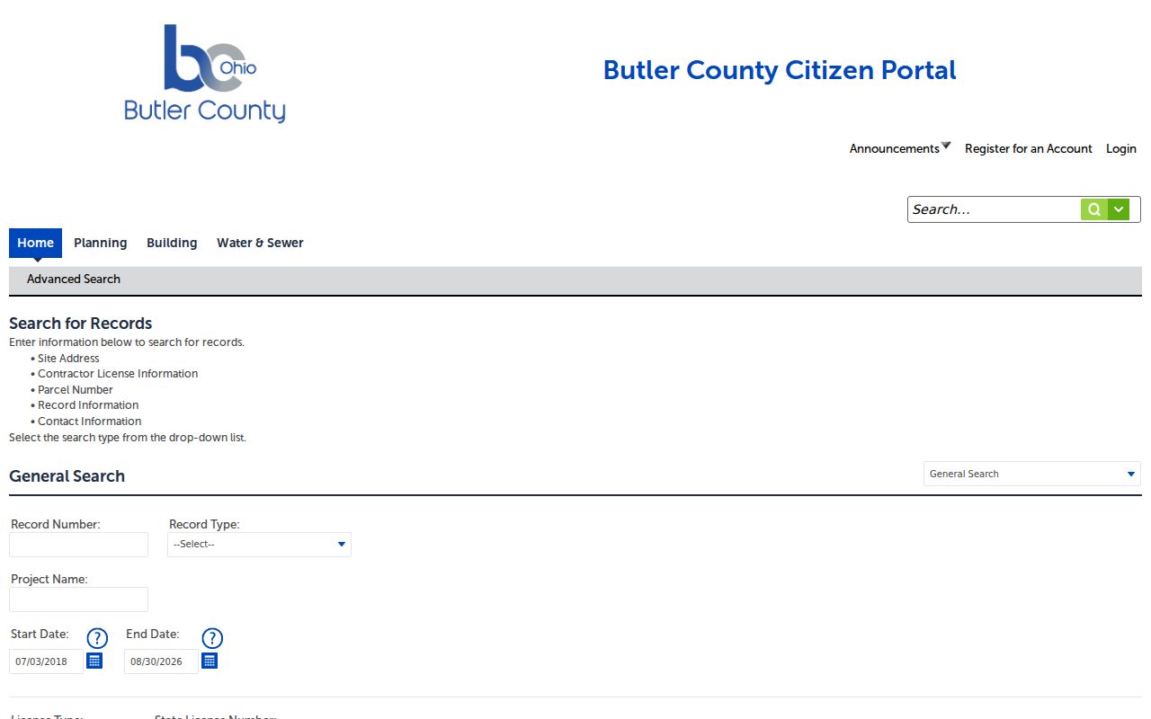
The county's Accela Citizen Portal is the relevant address route for Building, Planning, Water & Sewer, property information, and license-related applications. Anonymous viewing is stated to be available, while registration is needed for all services. Its Building search can be narrowed by search type, record number, date range, street number, direction, street name, street type, unit, parcel number, and City, State, Zip, and Country fields. A permit application can date work or connect an application to an address. It does not establish who lives at that address.
Use the Butler County Citizen Portal Building search when a record type and approximate date are known.
For a municipal address, the appropriate city department or a targeted public-records request is the fallback when no anonymous historical result is available. Include the address, parcel number if known, record type, and approximate date.
Butler County Municipal Context
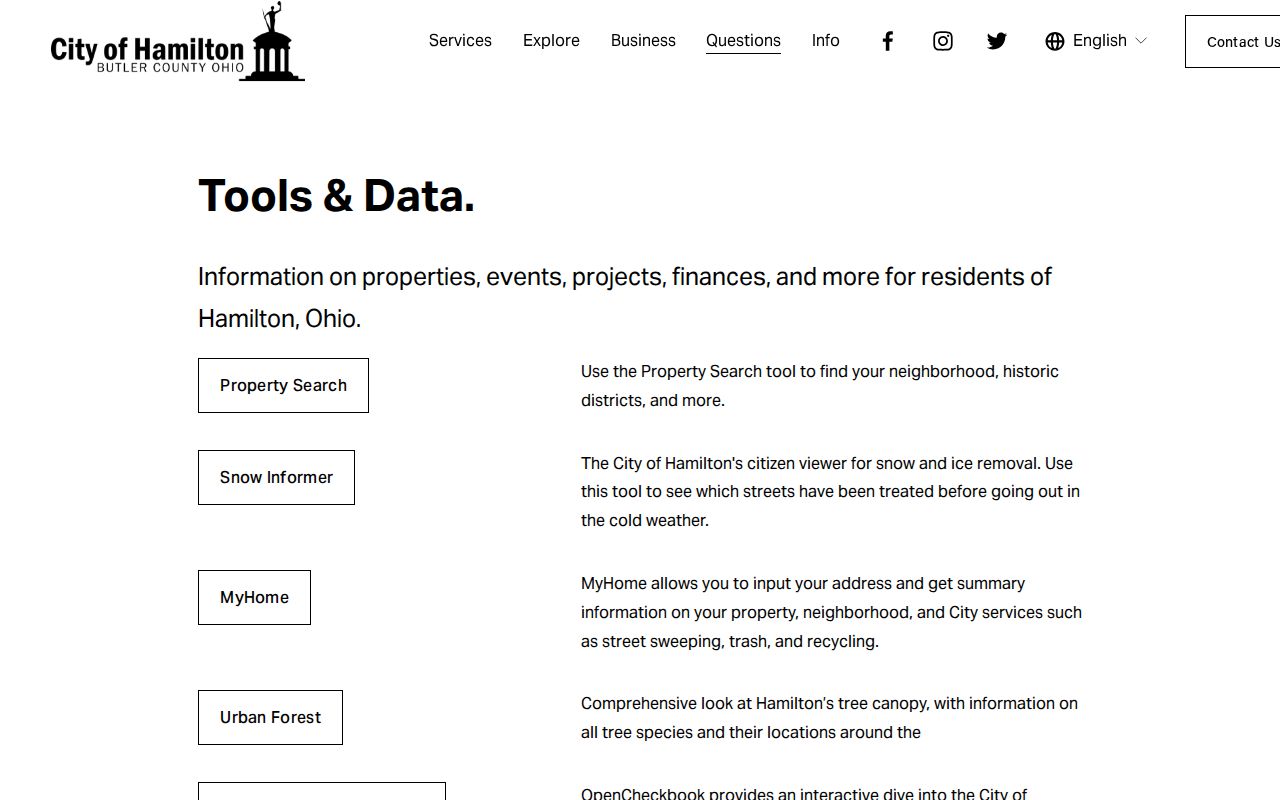
County and municipal address tools have different roles. Hamilton's Cityworks Customer Portal is an applications and payments channel for permits, licensing, land functions, and fees, not a verified historical address index. The city also offers a MyHome property search that accepts an address and can show municipal-service, neighborhood, historic-district, street-sweeping, trash, and recycling information. Pair that municipal context with the Auditor parcel record when the question concerns ownership or title.
The Hamilton tools and data page illustrates the municipal layer available beside county property records.
An address in Middletown needs the same jurisdiction check because Middletown includes land in Butler and Warren counties. Confirm the parcel and municipality before assigning a permit, court, or city record to Butler County.
Butler County Street Guides
Historic street evidence is strongest when the directory itself has a reverse or street section. The inspected 1949 Middletown volume includes a “Directory of Householders,” a street and avenue guide, a numerical telephone directory, classified listings, and an alphabetical list. The Williams Hamilton volume for 1861-62 has a Street Directory section. Those are documented examples, not a reason to assume every directory year is arranged the same way.
A criss-cross directory is a reverse directory arranged by address rather than by name. It can place a listed householder at a location for that edition, subject to publication lag. Lane Libraries and MidPointe offer local-history routes for directories, maps, yearbooks, newspapers, and research requests. The historical volumes themselves are covered in the Butler County city directory collections; use them with a close deed, map, or census entry for a careful date match.
- Parcel
- A tax and land-record unit identified by a PIN in the Auditor system.
- Situs address
- The physical location assigned to the parcel, distinct from a tax-correspondence address.
- Plat
- A recorded map that can identify lots, blocks, subdivisions, and related land layout.
- Criss-cross directory
- A directory arranged by address that may identify a listed householder for one publication period.
Butler County Street Geography
A road can have a postal label, municipality, township, school district, tax district, and parcel description that do not line up neatly. ZIP Codes are delivery tools, not city or county boundaries. Before choosing a city office for a street record, check the municipality and township in the Auditor or GIS data. A postal city can be a mailing convention rather than the jurisdiction that issued a permit or keeps a local court file.
For an older road reference, do not assume the current spelling or address appears in the deed or directory. Bridge the record with the PIN, legal description, subdivision lot or block, historic plat or atlas, closest-year Sanborn map, and the Recorder's geographic index. No official source reviewed for Butler County confirmed a countywide renumbering chronology, so a date should not be invented.
Note: A current ZIP can verify delivery for a known address, but it cannot select a Butler County property record by itself.
Butler County Street Limits
A street directory cannot establish every person who lives in a building. Parcel records may omit unlisted occupants, household members, adult relatives, utility customers, and delivery recipients. A tax-mail field can point to an agent, fiduciary, post-office box, or a different address. The county-owned sample in the Auditor research shows this distinction clearly: the parcel situs and the tax-mail addressee are different county offices. The map identifies a parcel boundary, not activity inside a home.
Ohio voter records have statutory redactions, and participants in the Ohio Safe at Home Address Confidentiality Program have protected address handling. Do not infer ballot choices from registration or participation data. Motor-vehicle data, utility lists, and private delivery information are not general public street sources.
Lawful use. Use Butler County address records for lawful personal, family-history, property, or civic research. Do not use a record to stalk, harass, or harm anyone.
Butler County Record Channels
Online search is only one access route. The Recorder's public-record policy allows inspection during office hours and explains written requests, historical books, visible redactions, and copy options. The Auditor provides parcel and conveyance routes at the county office. For a missing court file, the Clerk states that Common Pleas General and Domestic Relations electronic files run from 2000 to the present, while older material goes to the Records Center. A targeted request works best when it gives an address, PIN, owner or party name, record type, and date range.
The Recorder's free Property Alert can monitor a searched name, keyword, or found document for new recordings through a daily process. It is a monitoring aid, not a guarantee against property fraud. Retain the parcel PIN, legal description, document number, and date in a personal log so a counter, library, or records-center request can follow the same trail.